Bradley Stoke Library is staging a “Back to the ’80s” event on Saturday (21st May) to mark the 25th anniversary of the BBC’s Domesday Project.
The 1986 project was probably the most ambitious attempt ever to capture the essence of life in the United Kingdom. Over a million people contributed to this digital snapshot of the country.
People were asked to record what they thought would be of interest in another 1,000 years.
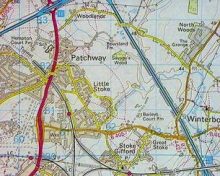
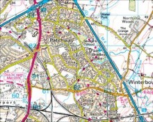
The whole of the UK was divided into 23,000 4x3km areas called Domesday Squares or “D-Blocks” (the maps above show 1986 and 2011 maps of D-Block GB-360000-180000, which covers what is now Bradley Stoke).
Schools and community groups surveyed over 108,000 square km of the UK and submitted articles and photos, cataloguing what it was like to live, work and play in their community.
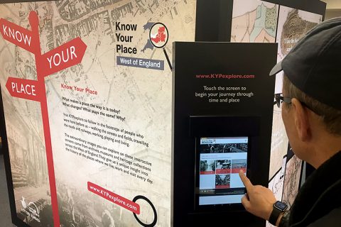
The data was originally stored on Laser-Discs but has now been transferred to the World Wide Web, where it can be viewed by a wider audience.
Saturday’s event runs from 9am to 4pm and highlights promised include films from the BBC Bristol archives, a 1980s news and music quiz, history displays, books and newspaper cuttings, BBC Sound Archive recordings as well as discussion about the origins of this once rural part of South Gloucestershire.
There will be a guest appearance from BBC Points West weatherman, Ian Fergusson between 10am and noon, while BBC Radio Bristol will be broadcasting live from the event throughout the day.
Cllr Heather Goddard, South Gloucestershire Executive Councillor for Communities, said:
“This is a wonderful opportunity for local residents to discover the roots of Bradley Stoke. The area is unrecognisable from the farmland and fields which stood here just a quarter of a century ago.”
Trish Campbell from BBC Learning added:
“We’re inviting everyone to come along to experience the way we lived in the 1980s and help us update the pictures and information. We’d love people to bring their photos and stories of modern day Bradley Stoke so that we can trace the changes over the last two and a half decades.”
A aerial photo shown on the BBC website show the Rolls Royce factory and part of the Filton Airfield runway in or before 1986. The “green belt farmland in the distance”, in which Savages Wood can be clearly made out (top left), is now covered by the town of Bradley Stoke.
A article titled Conservation on The Common expresses concerns that the new mini-town [of Bradley Stoke] will destroy Patchway Common, while another headed Local Issues in Patchway adds:
“Lots of people object to the idea of the mini-town planned for Patchway Common. Savage Wood may be axed and people are afraid that amenities will only be built after the planners have made their money. Should an aircraft have an accident it may damage the houses on the common. They also think that the existing roads are not sufficient to cope with the extra traffic.”


An article on the BBC Bristol website says sports commentator and former Bristol Rovers player Geoff Twentyman will also be at the Bradley Stoke Domesday Project event on Saturday: BBC Domesday Reloaded paints picture of Bristol in 2011