The formal adoption of South Gloucestershire Council’s long-term planning blueprint (Core Strategy) at a meeting of Full Council in December has paved the way for the construction of more than 12,000 new homes within a three mile radius of Bradley Stoke over the next 13 years.
The decision follows approval of the strategy by independent Government Planning Inspector Paul Crysell, who concluded, after 18 months of deliberation and negotiation, that the plan is ‘sound’ and suitable for adoption, subject to a number of final modifications.
When the draft version of the document was published in March 2010, the council was aiming to see 21,500 new homes built across South Gloucestershire over the period 2006 to 2027, but that figure has increased to 28,550 in the final version of the plan, following advice from the inspector.
Of that number, around 12,000 are planned to be built between now and 2027 within the North Fringe of the Bristol urban area, which is formed of Bradley Stoke, Cribbs Causeway, Filton, Patchway and Stoke Gifford.
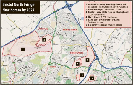
The bulk of that number will be built in two new neighbourhoods provisionally known as Cribbs/Patchway (5,700 homes) and East of Harry Stoke (2,000 homes). Approximately 2,000 more homes will be built at Charlton Hayes (Patchway) over the period of the plan, bringing the total number of homes on that development to 2,400.
The Cribbs/Patchway development includes 2,500 homes on the site of the former Filton Airfield, which became available for redevelopment after BAE Systems announced in April 2011 that flying operations would cease by the end of 2012.
Smaller developments include 1,200 homes on the recently-begun Crest Nicholson development at Harry Stoke, 500 homes on land to the east of Coldharbour Lane (currently used as a car park for UWE) and 490 homes on the Frenchay Hospital site.
The capability of North Bristol’s transport infrastructure to cope with new development that equates to a town almost one-and-a-half times the size of Bradley Stoke has been questioned by many, but an independent study commissioned by the council insists that by planning the new neighbourhoods “with an appropriate balance of housing, shops, services and employment”, the need for travel by car will be minimised.
In reaching its conclusions, the study draws on modelling results that predict an increase of 18% (by 2031) in the total number of “trips” made in the North Fringe area during a typical 12-hour weekday period. However, the authors claim that the number of car trips will increase by only 10% over the same period, due to the number of trips made by public transport increasing by an enormous 125% and walking/cycling trips going up by 20%.
The North Fringe to Hengrove bus rapid transit (MetroBus) route, which will run through Bradley Stoke, is seen as crucial in contributing to the expected “modal shift” towards the use of public transport.
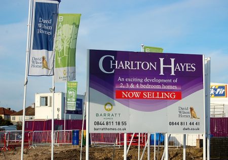
Photo: Archive image of house building activity at Charlton Hayes (credit: Patchway Journal).
Map: Sites of planned housing development in the North Fringe of Bristol (click to enlarge).
This article originally appeared in the January edition of the Bradley Stoke Journal magazine, delivered FREE, EVERY MONTH, to all homes in Bradley Stoke.


expected “modal shift” towards the use of public transport – yeah like as been promised many times before, completely deluded!