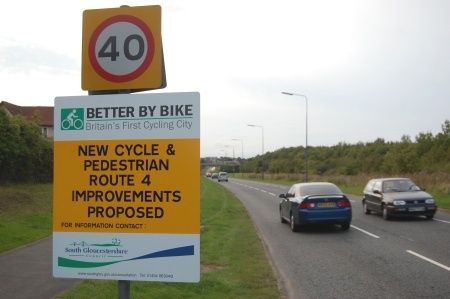
An exhibition has opened in Bradley Stoke Library to show plans of new cycle routes being proposed as part of the Cycling City project in South Gloucestershire.
Greater Bristol (the area governed by Bristol City Council and South Gloucestershire Council) was named as England’s first ‘Cycling City’ in 2008 and has received £11.4 million of government funding, matched by an equal amount from the two Councils, to promote and encourage cycling through better infrastructure, training and promotion.
Infrastructure changes being proposed under the scheme include a number of long distance routes linking centres of employment, education, shopping and housing.
Sections of two of the proposed long distance routes are set to be implemented within Bradley Stoke:
- Route 3 – linking Parkway Station to Bradley Stoke Leisure Centre
- Route 4 – linking Bradley Stoke to Cribbs Causeway via the Aztec West Business Park
Route 3 follows North Road and Mead Road through Stoke Gifford before crossing the Winterbourne Road at the existing pedestrian crossing. The route then follows the ‘Saxon Path’ between Watch Elm Close and Pursey Drive, crossing Arden Close before emerging onto Baileys Court Road.
A ‘level’ crossing on Baileys Court Road then takes the route on through Sherbourne Avenue and The Bluebells and down into the Three Brooks Local Nature Reserve. After passing under the Bradley Stoke Way bridge the route runs north between Bradley Stoke Way and Champs Sur Marne and on to the Leisure Centre.
Route 4 runs from the Willow Brook Centre along the west side of Bradley Stoke Way as far as Primrose Bridge. Then it runs up the ramp into The Common (East), across Brook Way and into The Common.
The route then continues via the existing A38 subway into Hempton Lane and onwards to the Aztec West Business Park and then Cribbs Causeway via the Patchway estate.
The exhibition in Bradley Stoke Library runs until Monday 5th October. The consultations close on Wednesday 7th October.
More information and related links:
- Consultation on Cycling City Route 3 (SGC)
- Consultation on Cycling City Route 4 (SGC)
- Walking and Cycling in Bradley Stoke (The Journal)
The Journal Comments
We had heard that the much-ridiculed disappearing/reappearing on-road cycle lanes along Bradley Stoke Way (see example pictured left) were to be removed as part of this scheme but were disappointed to find at least one of them still present on the plans.
While we do wonder how much demand there is going to be for ‘long distance’ cycle journeys along these fairly tortuous routes between Parkway Station and Cribbs Causeway via Bradley Stoke and Aztec West, the proposed works will undoubtedly bring welcome improvements for residents making shorter journeys in our town.
We welcome the proposed widening of the shared footpath/cycleway on the west side of Brook Way near Bradley Stoke Surgery – a notorious pinch point, where cyclists and pedestrians regularly come into conflict.
The extension of the path running up the east side of Bradley Stoke Way from the crossing between Snowberry Close and Champs Sur Marne up to the Savages Wood Roundabout also makes a lot of sense.


I am generally in favour of the proposals and I can see the reasoning behind this ludicrous route – the intention is to be as inclusive as possible and afford direct access to as many areas as possible. The inability to determine a simple, short route is one of the main issues with the NCN and many local routes IMHO.
Route 4: That there is already an ok (by no means perfect) route from BS through to Cribbs via the Savages Wood Road/Three Brooks path > Braydon Ave > Stoke Lane > Patchway Rail Bridge > Rodway Road > Sycamore Drive. I know there are a few missing links in this but it is quick, reasonably quiet and direct. Also is it just me, or does the footbridge at Patchway have steps? How are riders supposed to get a bike + trailer over, or a trike for that matter?
Once the North Field construction is completed cyclists would be better served by what I gather will be a bus only Highwood Lane!
Route 3: Remember – cyclists travel both ways! Whilst I agree that sending cyclists up over Mead Road and along North Road avoids the traffic on Hatchet Road, the climb may put off the more causal riders… Bailey’s Court Road will need some serious reworking to install an island or puffin crossing too bring the ‘level crossing’ to the same standards as those elsewhere on the road.
Also, why the need to paint green cycle lanes across junctions. These will only encourage ‘new’ cyclists to take up a weak road position near the kerb/merging traffic!
Just my 2p.
Craig,
Route 4 is not using the footbridge at Patchway; it is using the underpass near Patchway High School, removing the barriers that are currently there.
Cheers, Bert. That makes a little more sense; I completely forgot that was there.